


World atlas & world map MxGeo

Description of World atlas & world map MxGeo
World atlas & world map MxGeo is an educational app designed for users interested in geography. It offers an engaging platform for learning about the countries and territories of the world, making it suitable for individuals of all ages, including children, adults, seniors, and educators. This app is available for the Android platform, allowing users to download it easily to their devices.
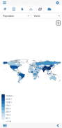
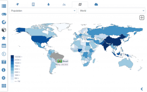
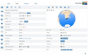
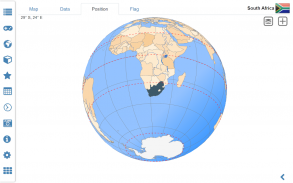
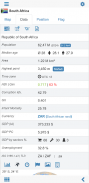
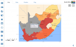
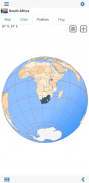
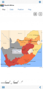
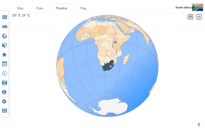
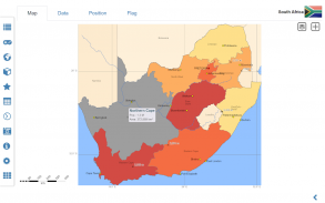
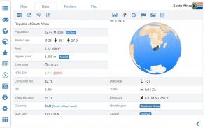
The app features a digital world map that showcases detailed geographic information. Users can explore more than 250 countries and territories, with essential maps and data available for each location. The interactive political world and continent maps enable users to visualize the geographical layout of different regions, while the shaded relief layer provides an additional perspective on the terrain.
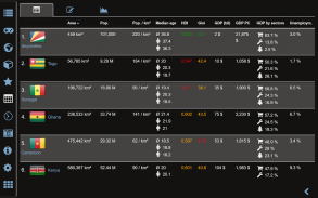
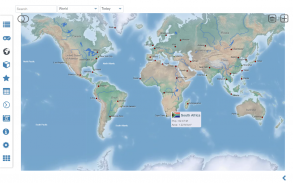
Users can search for various geographic entities, including countries, major cities, rivers, mountains, lakes, and specific coordinates. This search functionality enhances the educational experience by allowing users to find information quickly and efficiently. For those interested in specific regions, the app offers comprehensive maps and data for all African countries, including political boundaries and regional units.
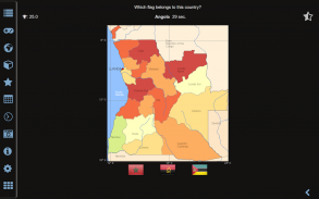
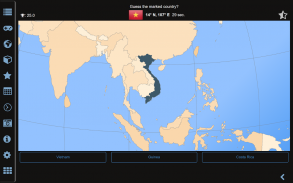
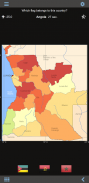
In addition to its mapping capabilities, World atlas & world map MxGeo includes various educational tools. One notable feature is the geography quiz challenge, which allows users to test their knowledge in a playful manner. This quiz covers a range of topics, including capitals of African countries, ISO country codes, and country flags based on outline maps. Users can also guess highlighted countries on a virtual globe and learn about the mountains in Africa.
The app includes a distance calculator that helps users measure distances between locations. This feature can be particularly useful for travelers or those planning trips, as it provides essential information for understanding the geography of different regions. Additionally, the world clock feature allows users to keep track of time zones across the globe, facilitating better planning for international communication and travel.
World atlas & world map MxGeo supports offline exploration, meaning users can access maps and information without an internet connection. This functionality makes it convenient for users to study and learn about geography while on the go, whether they are traveling or simply exploring from home. The app's offline capabilities ensure that users can always access the information they need, regardless of their connectivity situation.
The app also allows users to create their favorite color themes or choose from different color schemes for map displays. This customization feature enhances user experience by allowing individuals to tailor the app's appearance to their preferences. By doing so, users can engage more deeply with the content and enjoy a more personalized learning experience.
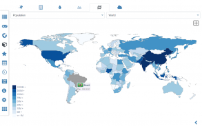
For those interested in comparing countries, the app provides a country comparison feature. Users can analyze various statistics and data points, enabling them to understand the differences and similarities between nations. This feature is particularly beneficial for educators and students, as it encourages critical thinking about global issues and geographic relationships.
The app’s world-explorer function presents interesting facts about countries, such as identifying the smallest or largest nations. This feature adds an element of discovery, encouraging users to learn more about the world around them. The app's diverse range of features caters to a wide audience, making it an excellent tool for both casual users and those seeking a more in-depth educational experience.
As users engage with the app, they can track their progress and revisit favorite countries or topics. This tracking feature supports continued learning and exploration, allowing users to build on their geographic knowledge over time. The app's design prioritizes user engagement, making it easy to navigate and explore a wealth of information.
In addition to its educational features, World atlas & world map MxGeo provides essential reference materials, including flags and basic data for each country. This information is crucial for users who want to gain a foundational understanding of global geography. The combination of maps, quizzes, and reference materials creates a well-rounded educational experience.
World atlas & world map MxGeo stands out as a versatile and informative app for users interested in geography. By offering an array of features that promote learning and engagement, it serves as an invaluable resource for anyone looking to expand their knowledge of the world. Users can download the app to start their journey of exploration and discovery today.
World atlas & world map MxGeo - Version 9.3.7
(10-02-2025)
World atlas & world map MxGeo - APK Information
APK Version: 9.3.7Package: de.mediaz.mxapp.hpbgeodefreeLatest Version of World atlas & world map MxGeo
Other versions


Apps in the same category